God's Artistry Demonstrated by Humanity and Nature
Before traveling here, I knew very little about Portugal and its history. Actually, before we landed in Porto, Portugal, years ago to go to Spain, I never even thought about it. Here are a few snippets about this wonderful country taken from Wikipedia.
Portugal is one of the oldest nation states in Europe and the world, its territory having been continuously settled, invaded and fought over since prehistoric times. Portugal, as a country, was established during the early Christian Reconquista, which was the period in the history of the Iberian Peninsula of about 780 years, ending in 1492 (a year we learned early on in our history lessons!)
In the 15th and 16th centuries, Portugal established the first global empire, becoming one to the world’s major economic, political and military powers. Portuguese explorers pioneered maritime exploration, notably under royal patronage of Prince Henry the Navigator and King John II, with such notable voyages sailing beyond the Cape of Good Hope in 1488, discovering a sea route to India in 1497-98, and the European discovery of Brazil in 1500. During this time Portugal monopolized the spice trade, divided the world into hemispheres of dominion, and expand the empire with the military campaigns in Asia.
However, events such as the 1755 Lisbon earthquake, the country's occupation during the Napoleonic Wars, the independence of Brazil (1822) and a late industrialization compared to other European powers erased to a great extent of Portugal's prior opulence.
After the 1910 revolution deposed the monarchy, the democratic but unstable Portuguese First republic was established, later being superseded by the Estado Novo authoritarian regime. Democracy was restored after the Carnation Revolution in 1974, ending the Portuguese Colonial War. The handover of Macau to China in 1999 marked the end of what can be considered the longest lived colonial empire.
Portugal has left a profound cultural, architectural and linguistic influence across the globe. It is a country with an advanced economy and high living standards.
My sister, Cathy, and her husband, Shahid decided that Portugal was going to be the place they would retire. They had a wonderful home built and will be retiring there next year. Learning that after the multitude of countries they have visited over their lifetime, they decided to retire in Portugal, Roger and I knew there must be something quite spectacular about it, so we thought we should visit. We timed the visit to catch the end of Shahid's winter break to spend some time with them!
My sister and husband, Shahid, taking us to a New Years Eve party.
Here we are ready to go out for the evening!


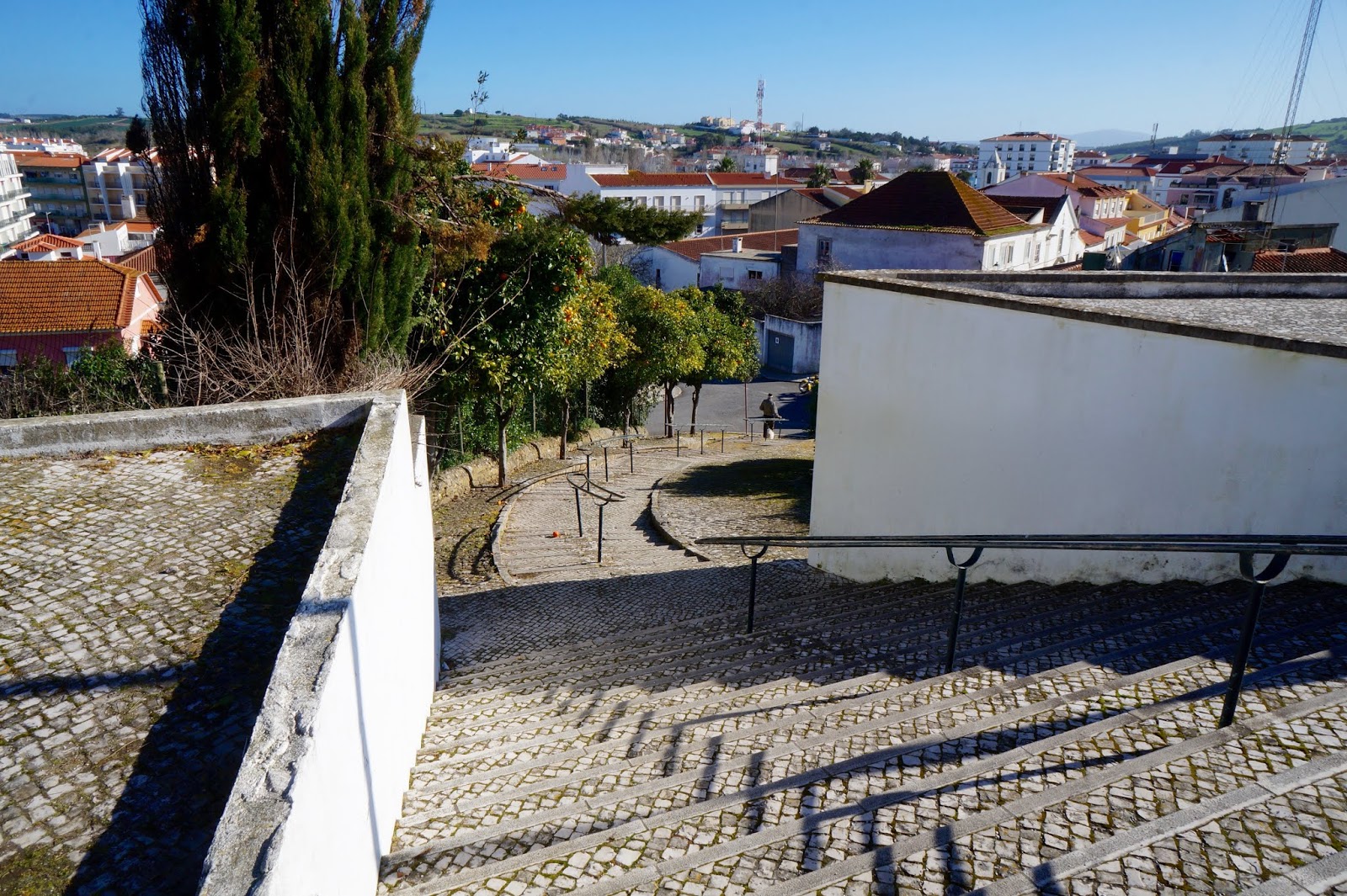
Cathy and Shahid took us to several wonderful places near Areia Branca, Portugal, where they will be living. One of the first places they took us was the magical city of Obidos.
Obidos
Obidos (which spell correct keeps trying to make obits) is considered one of the top towns to visit in Portugal. It is believed that Obidos existed before the foundation of Portugal, and has maintained its old-town charm. It has cobbled streets and narrow winding passages. The name "Óbidos" is a Latinised derivation of the older Celtic “Eburobricio”. Archeological evidence from the base of the medieval tower at Obidos Castle indicates Roman construction linked to an outpost of the Roman civitas of Eburobrittium, a large urban area that has been under excavation.
 |
| One of the first thing I noticed as we neared the town was this aqueduct. Quite spectacular! |
The aqueduct’s destination was the Chafariz Real (Royal Fountain) on Praça de Santa Maria, and for half of its length it travelled underground.
As the main supply of water to the town, this structure served its purpose for well over 200 years, and its high arches were repaired twice, at the end of the 1600s and again a century later.
The most impressive stretch is just at the southern entrance to Óbidos.

Town Gate and Our Lady of Piety’s Oratory
Main access door to the town of Obidos, concluded approximately in 1380. It shelters the oratory dedicated to Obidos. Our lady of Piety, concluded in the 17th century, with remarkable tile covering from 1740-45


 |
Saint Mary’s Church (Our Lady of the Assumption)
Erected in 1148, during the reign of King Alfonso Henriques, by order of Saint Teotonio, it was rebuilt in the 16th century.
|


 |
Pillory
Built in 1513, it is a symbol of municipal power. It holds the coat of arms of King Manuel I and Queen Leonor de Lancastre ( the shrimp net, in memory of the loss of her son the Royal Prince Afonso)
|


 |
| Outside the wall |

 |
| Two of the many cats we saw, peering down at us! |


 |
Old churches dating to a hundred years and rock-solid stone rooms are converted into bookshops in Obidos, accommodating a humungous collection of books of all kinds.
|

Views from the upper areas of the town.


Outside the walled city


Views around the castle


Peniche
Peniche is a beach destination and a fishing port with a long history. It has had a fort since early the Modern Age constructed to defend the area. The city was built on a rocky peninsula which is considered by geologists a unique example of the Toarcian turnover during the worldwide Early Jurassic extinction. This is probably what caused the unique rock formations we found.


We really loved the diagonal rock formations! It is incredible to think
of what had to happen for this to be formed!


Palacio de Mafra
We decided to go to the Palacio de Mafra (Palace of Mafra) or as we referred to it, the Mafia Place!
The Palacio de Mafra is, in all aspects, a remarkable building. Remarkable for its brilliant and complex architectural design, for the quality and nature of its materials and orders, and for the refinement and excellence of its marbles.
One if the first expressions of globalization (from the gold from Brazil to the European orders), the monument is, with its Library , its six organs and the two imposing Carillons (the biggest historic bell/musical complex in the world) one of the most important Baroque Monuments.
King Joao V had it built in the first half of the 18th century, in fulfillment of a vow to obtain succession of his marriage to Maria Anna of Austria, or for the cure of a serious disease he suffered from. The building comprises a Royal Palace, a Basilica, a Convent and Hunting Grounds. The building is symmetrically developed from a central axis, the Basilica, the main spot of a long facade flanked by two towers, and in the rear, by a convent for the Order of Saint Francis of Province of Arrabada, also occupied by the Arrabida between 1771 and 1792.
 |
| We knew it was going to be a fun day when we parked next to this space!! |


 |
| Courtyard |


The first room up the stairs had various representations of the nativity scene using multiple mediums.


The Baptismal font below is painted wood, 19th century. It was especially made for Princess Ana de Jesus Maria, daughter of King Joao VI, born in Mafra and baptized in the Basilica.
The canvas is: Our Lady appears to St Giovanni di Motta, founder of the Trinitarian (or the Holy Trinity) Order.
Andre Goncalves, 18th century

Saint Martyrs of Morocco
Terracota, Anonymous, 18th Century
In 1219, six Franciscan friars, Vital, Berardo, Peter, Acurcius, and Otto were sent to evangelize Spain. Reaching Aragon, they had to leave Brother Vital behind, as he was ill, and proceeded to Portugal and the to Sevilha, at the time a moor city, where they preached the Gospel to the Mussulman king. He sends then to Morocco. There they continue preaching until they finally are decapitated. They were the first Franciscan martyrs. The news of their martyrdom made St Anthony change from the Saint Augustin Order into the Franciscans.


The wood sculptures represent S Joseph, St Anthony and Little Jesus, St Peter of Alacantara,
St Francis of Assisi, St Berard and the Virgin Mary, Jose de Almeida

Processional lamps in bronze, golden silver processional cross, maces and Franciscan emblems in engraved golden wood with the Royal Crown, the inscription Royal Basilica of Mafra and the Franciscan Coat of Arms, 18th Century


Friar’s Cells
Cells for the nursing brothers. Oak and Brazilian oak furniture. 18th century. The four sided bed in the cell on the right was used for patients with high fevers or a mad monk.


Infirmary’s Kitchen
Meals were prepared here for the nursing brothers and the sick. Originally there were three more kitchens in the building One for the king, another for the queen and one for the convent.


Infirmary
This ward was for the seriously ill whom nursing brothers cared for. The doctor and the drawer of blood visited the sick every day. At the head of each bed there is a tile panel of Christ and at the foot one of the Virgin Mary. The doctor used to hang the prescription on a hook so the patient could see if the friars were carrying out the correct treatment. On Sundays all beds were pulled into the center of the ward so the patients could take part in Mass. The steps lead down to the cemetery.


King and Queen’s private apartments
The private apartments of the King (North Tower) and the Queen (South Tower), had both their own kitchen in the basement, the buttery and store rooms in the ground floor, the Chamberlains rooms in the 1st floor, the Royals lodgments in the main floor and the servants in the loft. They were used during all the 18th century and until the death of King Fernando of Saxe-Cobourg (1885), when the Royal family moved to the South Wing, reserving these apartments to important guests visiting Mafra.
 |
| King's Bedroom |
 |
| Queen's Bedroom |


 |
| Crown Room |

Various Rooms and Ceilings in Palace

Throne Room
Used for royal audiences. The painting of the ceiling represents an allegory
to “Lusitania,” and on the walls, the eight Royal Virtues.


Benedictine Room
Located in the middle of the Royal Palace this hallway seems to be integrating part of the Basilica. From its windows the Royal Family was able to attend religious ceremonies and from the outside balcony King Joao V used to bless the people.


View inside the Basilica from Palace Hallway


Reception Room


Music Room
Game Room


The Trophy Room
The Palace of Mafra was never a regular residence,
but the Royal Family frequently occupied it for short period dedicated to the hunt in the Reserve nearby.


Although we associate the word magic with illusionists, that’s not always been the case. Mafra presents an unprecedented exhibition, told from the perspective of an in-depth look into magic and the scientific study of the book collection of the Library of the Palacio Nacional de Mafra. The original works, dating from the 15th to the 19th centuries reveal the different concepts that defined magic through out the occult, natural, mechanic, recreational, and diabolical.
The Catholic church eventually included a vast majority of these works in the Index of Forbidden Books which condemned their reading and prohibited their circulation. however, papal brief sent to Portugal by Pope Benedict XIV grants Mafra’s library permission for keeping forbidden books as long as the friars studied them in secret.


Library
Occupying the largest and most prestigious room of the building, the Library is one of the most significant Enlightenment Libraries in Europe, with around 36,000 volumes amassed through royal commission.
The collection includes books on subjects as diverse as Medicine, Pharmacy, History, Geography, Philosophy, Theology, Canon and Civil Law, Mathematics, or Literature.


Dinosaur Park
A rare dinosaur skeleton and one of the oldest in the world has been discovered in the south of Lourinhã, Portugal. The remains under study appear to be of a coelurosaur, a rare relatively small carnivorous dinosaur, less than two meters long, from 150 million years ago.
“It is certainly the most complete dinosaur we have in Portugal and one of the most complete from the Upper Jurassic in the whole world. This means that we can now better study how dinosaurs have evolved and how they turned into birds,” said Mateus, a researcher at the Universidade Nova de Lisboa associated with the in the Jurassic Museum of Lourinhã.
According to Mateus, it is uncommon to find such a complete coelurosaurs skeleton “So this is the first complete articulated coelurosaur found,” he said.
A full-scale Tyrannosaurus rex is just one of the prehistoric highlights on display at Portugal's self-proclaimed "dinosaur capital," a new theme park in one of the most fossil-rich regions in Europe.
"We have 120 large-scale reproductions of 70 different species, spread over 10 hectares," Simao Mateus, Dino Park's scientific director told AFP.
Although only recently opened, the park sits in a part of Portugal long famous among paleontologists for its extraordinary array of fossilized remains.
The town of Lourinha has been dinosaur-mad ever since the remains of a dozen of the creatures were discovered in the late 19th century.
It already has a dinosaur museum and dinosaur statues in metal or resin can be seen on its roundabouts, while pavements are decorated with paintings of dinosaur footprints. "Lourinha is quite particular about its dinosaurs, so we should all enjoy" the new facility, Mateus said.
Pride of place goes to two models of dinosaurs actually discovered in the town.
Lourinhasaurus was a sauropod -- an immense, four-legged herbivore similar to Brachiosaurus or Diplodocus -- that roamed the rainforests of western Laurasia around 150 million years ago.
That gentle giant is not to be confused with Lourinhanosaurus, a sharp-fanged and crafty hunter the size of a crocodile that lived in roughly the same era as Lourinhasaurus.
Cathy and Roger decided to go and check out the Dinosaur Park and see what mysteries unfold!


The museum part was a lot of what they anticipated seeing with its bones and information.
Outside was more a park that had models of the various prehistoric beings


Lourinhausaurus first remains were found near Lourinha in 1982, but were not described until 1998 by Octavio Mateus. The specimen found was a sub-adult, measuring 4.5 m in length and weighing around 160 kg. A full grown adult would have been 8 meters long taking 10 years to reach that size. Besides these specimens, around 100 eggs, some of them containing embryonic bones, have been found in 1993.


Fatima
Cathy brought us to Fatima. Fatima is a central Portuguese town that is home to the Sanctuary of Fatima. In the summer of 1917, the Virgin Mary is said to have appeared to three young shepherds in what is now the town of Fatima. The first place of worship, a simple chapel, was founded in Fatima after the sightings and completed two years later in 1919. It was built to fulfill the supposed request Mary gave to the three shepherds and is now housed in a larger modern building with rows of benches for devotees. This has become an important pilgrimage site.

For many Catholics, standing on this gigantic plaza could be a lifetime ambition. At each end of the square are Fátima’s two basilicas, and there’s a large modern crucifix in front of the newer of the two on the south side. The most spellbinding view faces down the slope towards the older sanctuary, which is winged by a colonnade.


Scenes around Areia Branca and Lourinha
Views from Rooftop of Cathy and Shahid's house


Along the pathway to the beach


And back up the path


Scenes around Lourinha
The name Lourinha possibly originated in the period of Roman domination, when a villa was located in the area. The origin of the medieval village is linked to Jordan, a French Knight, who took part in the successful Siege of Lisbon in 1147. King Afonso Henriques granted Jordan the region as a fief and allowed him to grant a formal (letter of feudal rights) to its settlers in 1160. The name Lourinha may be related to the origin of its feudal lord, since Jordan was from the Loire region in France.


 |
| These caterpillar and marching toward a pupation site, where they can bury themselves in the soil and form cocoons. |

Santa Maria do Castelo Church and the cemetery


There is a nice view of the town from the cemetery


Scenes around the town


Capela de Santa Marta

Areia Branca- the beach town where the house is located


Vimeiro


In the Battle of Vimeiro on August 21, 1808, the British under the General Arthur Wellesley (who later became the Duke of Wellington) defeated the French under Major-General Jean Andoche Junot near the village of Vimeiro during the Peninsula War. This battle put an end to the first French invasion of Portugal. Four days after the Battle of Rolica, Wellesley’s army was attacked by a French army under General Junot. The battle began as a battle of maneuver with French troops attempting to outflank the British left, but Wellesley was able to redeploy his army to face the assault. Meanwhile Junot sent in two central columns but these were forced back by sustained volleys from troops in line. Soon afterwards, the flanking attack was beaten off and Junot retreated towards Torres Vedras having lost 2,000 men and 13 cannons, compared to 700 Anglo-Portuguese losses.


The park in the middle of the village had
several tiled placards with images of the battle.


Torres Vedras
The focal point for visitors to Torres Vedras is generally the 13th castle which sits atop a steep hill overlooking what is otherwise a flat town. Once a favored royal residence the castle was more or less reduced to rubble by the great earthquake of 1755. What you see today is a combination of the old castle keep and walls, which have been rebuilt and restored at various points in history according to the needs of the time.


Zambujal is a 5000 year old fortified hill settlement. It was inhabited between 2850 BC and 1750 BC in the Chalcolithic period, defined by the continued use of stone tools (lithos in Greek) and the first appearance of copper materials (kalko in Greek).
The Chalcolithic was preceded by the Neolithic period, which saw the earliest agricultural societies, and was followed by the Bronze age, when metallurgy produced a tin and copper alloy that was much more resistant than copper alone.
The constant wars of this time and the consequent need to protect territory, people and goods (such as gold, copper, and ivory) led to the appearance of complex fortifications in the west and south peninsula.
It is in this context that Zambujal emerged and evolved by adopting new defensive strategies. The need to establish lines of defense, while keeping social structure with specialization of tasks- from war to metallurgy or agriculture- led to social differentiation.
Zambujal is located on a high site with good visibility and control over the Riberia dos Pedrulhos and the River Sizandro. Maritime resources were accessible though a bay about 1 kilometer away. Small boats were used to navigate the river due to the shallow depth of the estuary.


From the 4th to the 3rd millennium BC, there was a significant development of military architecture in the Iberian Peninsula. The Zambujal archaeological site is a paradigmatic example of these fortifications. The walls were built with stone extracted from the spur, where the village is located. On site rock extraction reduced the workforce travel needs and the quarry exploration areas were converted into ditches attached to the walls. The walls consisted of two exterior sides of carved stones that were filled with a mixture of earth, bones, and ceramics. The width of these walls could reach up to 16 meters.
In comparison with other fortified settlements in the Iberian Peninsula, Zambujal is in a remarkably good state of preservation.The central area is accessible through the entrance at the front. Over time, this entrance has undergone several changes, such as new facades built against the original wall.


Thousands of arrowheads have been collected in Zambujal and, although the introduction of the bow and arrow allowed for hunting large animals, few of their bone remains have been found, likely indicating that the weapon had a mainly defensive role.
In this central area, the barbican, attached to an original section of the wall, stands out. This construction had small windows directed towards existing entrances, as a second line of defense that allowed for shooting directly at the enemy in case of attack.
The entrances and windows of the Barbican were later closed out, indicating a change in the defensive strategy. Next to the barbican is a large tower dating back to the earliest period of Zambujal.
This proves the presence of a warrior class in the Bell Beaker period.In the graves from this period, for the first time in the History of Mankind, male individuals were buried with all their warrior attributes.


The Hut of Zambujal
The huts were circular structures 3-7 meters in diameter. They were composed of stone wall bases and mud mixed with tree trunks for the rest of the wall. Covered with thatched roofs, the huts would occasionally have a fireplace and paved floors. They were both residences and workplaces for metal workers.
Many copper artifacts have been found in Zambujal that often help identify social differentiation, and the metal workers likely had a prestigious status in the community. The transformation of ore into copper artifacts is an arduous task, requiring skills and expertise:
-Selected malachite was the raw material for making copper
-Raw material was broken into pieces and placed into crucibles- ceramic vessels that could withstand very high temperatures
-The crucibles filled with malachite were placed in the fire until the stone became an incandescent viscous paste: liquid copper
-The liquid metal was poured into clay molds in the shape of the desired artifacts
-The mold was then cooled
-The copper artifacts were extracted from the mold and hammered
In Zambujal, however, small spheres of copper were found, indicating that the copper would arrive here already transformed and was then melted to make new artifacts.

The Sizandro River Valley
5000 years ago
The Sizandro River Valley was different 5000 years ago. It had deep river beds and seawater reaching only 1 kilometer from Zambujal.
The vegetation consisted of vast agricultural areas in the Sizandro River Valley and forest areas around the River Alcabrichel: a forest with mainly oak and cork trees populated with animals such as bears, aurochs, cervids, wild boars, birds of prey, partridges, and small animals, such as rabbits, hares, and other rodents.
Populations kept domestic animals, such as sheep, goats, pigs, and cattle.
A study of pollen from the Sizandro River Valley shows great change in vegetation at around 5300 BC, probably the result of agricultural development. Seeds collected at Zambujal indicate that local diet was based on broad beans and grains, such as wheat and barley. It is still unknown where the inhabitants of Zambujal buried their dead.


The 5 Phases of Zambujal
The Zambujal hill fort was inhabited between 2850 BC and 1750 BC and was successively destroyed and rebuilt. Five phases of adaptation of the walls to different concepts of deference have been defined:
- Starting around 2850 BC, the site is defined by a walled enclosure with massive towers. The interior was composed of courtyards, separated by radial walls. Narrow passageways between the courtyards created a labyrinth system protecting the central area (1st wall line). The defense strategy consisted of trapping the enemy in the inner courtyards if they got inside the walls. Man to man confrontations were complemented by an attack from above with bow and arrow from the top of the walls and towers.
- Around 2650 BC, the radial walls were internally removed and the four wall lines were kept along the East side of the spur rise, towards the ocean. Barbicans were built, one of them next to this panel. The barbican of the central enclosure has eight windows pointing towards the entrances in the second wall line. Defense was done at ground level.
- Around 2600 BC, a few towers were built in the second line and previous entrances were closed. The barbican underwent alterations with a partial filling of its hollow space and closing of the small windows. Large platforms were created at the top of the wall for circulation of people; stone or wooden constructions may have existed for the protection of the warriors. Attacks were made from above, as in phase 1. Houses appeared in the zone between the defensive lines. The production of bell-shaped ceramics begins to be well documented.
- Around 2450 BC, in order to cover the flanks, large hollow towers were built attached to the raised platforms. They were composed of stone and earth bases, false domed walls and covered with thatched roofs. These 2 meter high towers had beaten earth floors. In some towers, the false dome had a central hole that gave access to the thatched roof for sentinel archers.
- Dating back to 1850 BC, there was a phase characterized by the thickening of the first line of the wall and the addition of a new facade connecting the hollow towers A and B. In the second line, access corridors to the central enclosure were created, ending in a ditch. If the enemy crossed this line, they would fall directly into the pit. This stage represented the end of the prehistoric occupation of Zambujal. The abandonment of the site may have been due to a change in the environment. Erosion and shallow estuaries rendered the area marshy and disease-prone. Zambujal was partly occupied once again in the early Iron Age. In Roman, medieval and modern periods, small manor houses were built using the stones of Zambujal as raw material, two of which are still visible.


Nazare
Nazare, named after the Biblical “Nazareth” in the 4th century, is Portugal’s most famous fishing village, now becoming important as well in the world of big wave, tow-in surfing. The tallest wave ever recorded being surfed – by a Hawaiian big-wave surfer – was off Nazare.
Obviously the day we were there was not a big wave day, but I have seen pictures, and they seem unreal. One of the pictures estimated the wave to be 29 meters.


 |
| Looked like this dog was waiting for his order! |
Serra da Estrela
So far we have taken only day trips. We decided for my birthday weekend, we would go to the Serra da Estrela, spending a couple nights there.
The Serra da Estrela (Star Mountain Range) is the highest mountain range in Continal Portugal. Together with the Serra da Lousã it is the westernmost constituent range of the System Central and also one of the highest in the system. It includes mainland Portugal's highest point at 6,539 feet above sea level. Mount Pico on the Azores is Portugal’s highest point.
Castelo Branco

Castelo Branco gets its name from the prior existence of a fortified settlement called Castra Leuca, on the summit of the hill of Colina da Cardosa. Little is known of the history before 1182. There is, nevertheless, a document, from this date, mentioning the donation to the Templars of a piece of land called Vila Franca da Cardosa, by a noble Fernandes Sanches. In 1213 it received its autonomy or foral and the name Castel-Branco appears for the first time. Pope Innocent III confirmed this in 1215 giving it the name of Castelo Branco. It was around this time that the Templar Knights built the walls and the castle. In 1510 a new foral was conceded by Manuel I and in 1642 the town acquired the status of Vila de Castelo Branco. In 1771 Castelo Branco became a city. In 1959 it became capital of the district of the same name.
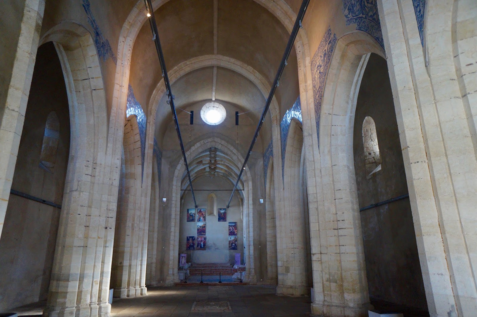
We stopped at one of the many churches in Castelo Branco. They are often refuges in the busy, bustling towns. Once stepping inside, my thoughts quieted, and I was able to take in the beauty and peace of our Lord.


From outside the church we could see the castle.

 |
| One of the many examples of the buildings being decorated with tile. |
Castelo e Muralhas
After circumnavigating the streets of the town and getting lost several times, we eventually reached the medieval castle that gave Castelo Branco its name. This is the highest point of the city, and the outline of the single tower can be seen from quite a distance. The castle was a Templar fortification, raised at the beginning of the 13th century. It experienced damage in the Portuguese Restoration War in the 17th century, and then again in the War of the Spanish Succession and Napoleon’s Peninsular Wars. By the 1800s its stone was quarried for houses in the city.


Igreja de Santa Maria do Castelo
Built probably in the 12th century, it was rebuilt in the 13th century by the Templars, and later suffered several acts of vandalism being reduced to ruins. In the following times the building underwent successive interventions currently and, almost in its entirety, a work of the first half of the 19th century.


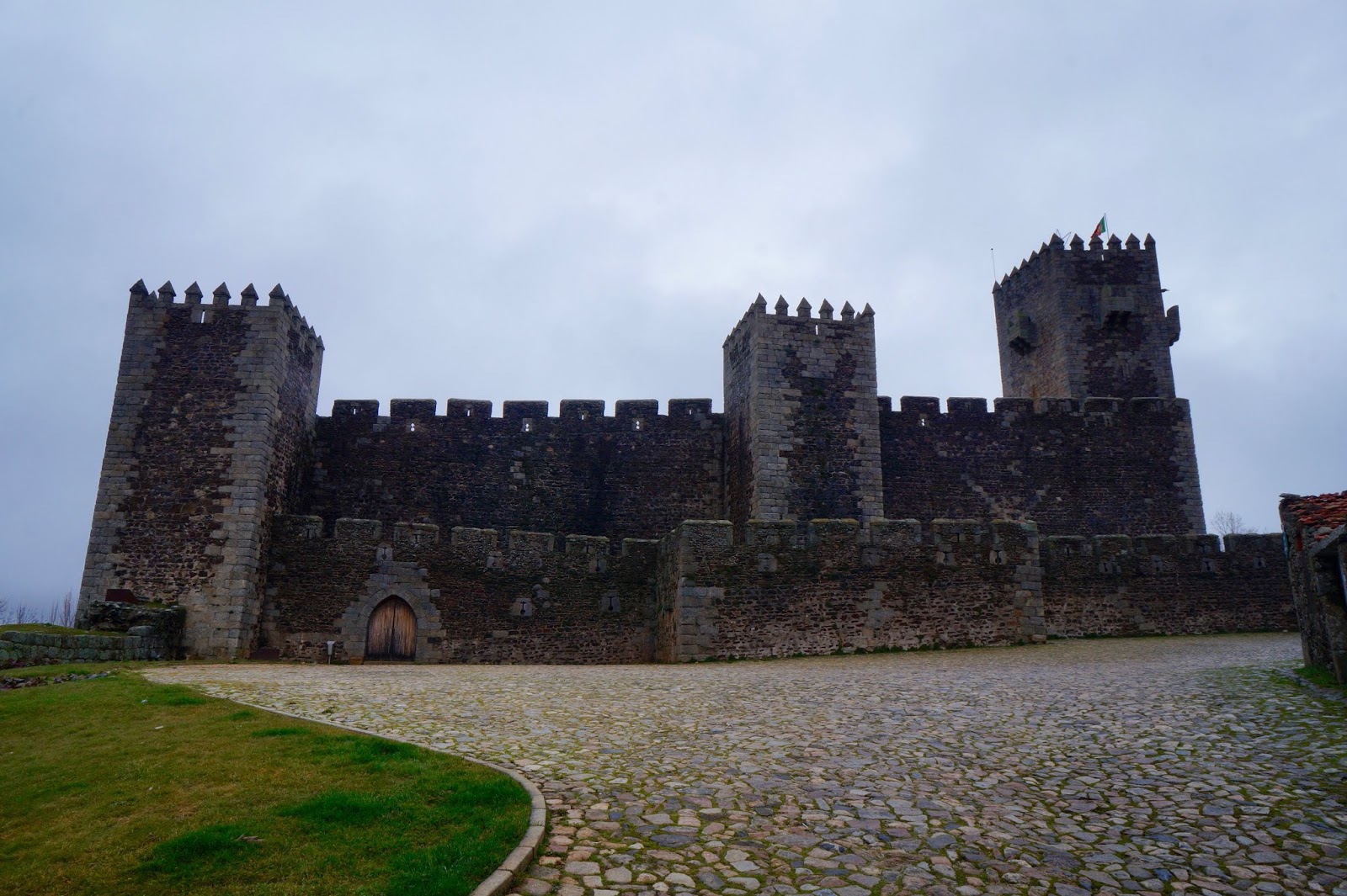
Cro Hotel Rural, Sabugal, Portugal
On the grounds of the hotel in which we stayed, were ruins. Roger went out to explore.


 |
| Cao River |


Sabugal
Sabugal was the location of the 1811 Battle of Sabugal, a Peninsular War engagement of British troops under Arthur Wellesley (later the Duke of Wellington) and French troops under the command of Marshal Andre massena, from which the British emerged victorious.

The Sabugal Castle is a castle in the city in the city of Sabugal, near the Coa river.


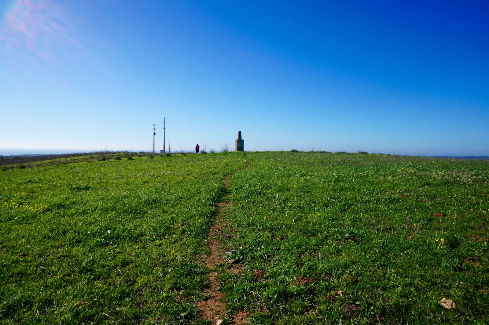
Driving over the Serra De Estrella, the weather got cloudier and cloudier.


In the middle of one of the very sharp U's in the road, we saw this collection of vases and rock formations.


The weather is getting colder and cloudier as we climb!


At the top, we found a bit of snow!


We would have taken more pictures, but this is all we were able to see. Not prime picture taking weather. What we could see was phenomenal!


The Algarve
Our next trip was to go to the Algarve. The Algarve is the southernmost region of the continental Portugal. It is one of the most developed regions of Portugal. Human presence in southern Portugal dates back to the Paleolithic and Neolithic periods. The presence of megalithic stones in areas attest to this presence.
In the 15th century, Prince Henry the Navigator based himself near Lagos and conducted various maritime expeditions which established the colonies that comprised the Portuguese Empire. Also from Lagos, Gil Eanes set sail in 1434 to become the first seafarer to round Cape Bojador in West Africa. The voyages of discovery brought Lagos fame and fortune. Trade flourished and Lagos became the capital of the historical province of Algarve in 1577 and remained so until the 1755 Lisbon Earthquake. The earthquake damaged many areas in the Algarve and an accompanying tsunami destroyed or damaged coastal fortresses, while coastal towns and villages were heavily damaged except Faro, which was protected by the sandy banks of the Ria Formosa lagoon. In Lagos, the waves reached the top of the city walls. For many Portuguese coastal regions, including the Algarve, the destructive effects of the tsunami were more disastrous than those of the earthquake itself.
Palmela
Our first stop on our way to the Algarve was a town named Palmela. Palmela is a charming small town centered around a fortified castle at an altitude of 1200 meters at the edge of the Arrábida mountain range. Its past strategic importance is evident given that the views from here are astounding, taking in vast expanses of farmland, the Sado estuary to the south and even Lisbon to the north.
Originally a Moorish stronghold, the castle was constructed following the reconquest in the 12th century and remains a solid example of fine military architecture of the time. It is thought that the Bishop of Évora died a painful death in the dungeon here, punishment for his part in a conspiracy against the 15th century King João II. A monastery was also added to house the faithful of the Order of Santiago, and it is this part that has been painstakingly transformed into possibly Portugal’s most desirable pousadas (boutique hotel).
Although not a million miles away from the capital, Palmela lies at the heart of one of Portugal’s richest wine growing regions, often growing the Periquita variety of grape. This is reflected in the lively local festivities, the Festa das Vindimas, which take place in September to celebrate the wine harvest.
We stopped at the castle of Palmela to look around and ended up eating a lovely breakfast there.

There are some quite spectacular views from the castle.


Igreja de Santiago de Palmela
Located within Palmela castle, the convent’s construction was ordered in the 15th century by King Koao I, grand master of the Order of Santiago. The church is now classified as a national monument.


Belvedere Castle of Palmela
In this place, one can take a see the beauty and uniqueness of the spot. The landscape bears witness to the strategic positioning of the castle as a center of power and military stronghold of a vast territory, and explains the installation of a post for the Portuguese Army military transmissions at the end of the 19th century.


 |
| The town of Palmela |


 |
| Windmills are all over Portugal, both modern and historic. These have been transformed into Bed and Breakfast locations. |

 |
| Some of the artifacts dug up from this location |


Aljezur
Aljezur is a small market town of whitewashed houses and cobbled streets located thirty kilometers north of Lagos in south west Portugal. Straddling a fertile river valley, famed for its sweet potatoes, the town is dominated by the ruins of a tenth century Moorish castle, which sits at the top of a narrow and very steep cobbled hill. Views from the top of the hill of the castle are spectacular. On one side of the river stands the old town, which dates back to the tenth century when the Moors first settled here. Christian armies conquered the town in 1246 and five centuries later, when Aljezur was rife with malaria, the Bishop of Algarve ordered the town's inhabitants to move to the other side of the river to escape the disease. 


Lagos
Lagos is a historic and characterful city that is situated on the beautiful Western Algarve. It is a city that boasts a rich seafaring heritage and a coastline of dramatic natural scenery, and today is one of the Algarve’s finest holiday destinations.
For a holiday, Lagos offers picturesque beaches, buzzing nightlife and outstanding tourist facilities. Thankfully, Lagos has not succumbed to mass tourism, and the city still retains its distinctive character and charm. Found within the historic centre is a proud Portuguese city, with cobbled streets, authentic restaurants, and an atmosphere which is relaxed and welcoming. Lagos perfectly combines traditional Portuguese culture, with beautiful beaches and modern tourist facilities.

Lagos was the first coastal town we got to in the Algarve. We stayed at a lovely hotel with this awesome view from our balcony.


We loved going to this spot and walking along the coast watching all
the dogs and their owners on the beach.

On our way to Sagres, we saw a sign that promised some megaliths. We did not find them, but it was still a cool spot.

Sagres
Sagres is at the extreme western tip of the Algarve and is like no other destination in southern Portugal. It is a region for the adventurous, the intrepid and those who seek to pit themselves against the wild environments. These dramatic landscapes are dominated by nature’s raw power; from the raging seas that carve immense cliffs, the bracing winds that create barren landscapes, through to the intense summer sun.


The Sagres Promontory became the headquarters of Prince Henry the Navigator and a key location of the Age of Discoveries that marked the expansion of European culture, science, exploration and commerce both towards the Atlantic and the Mediterranean, setting European civilization on its path to the global projection that came to define the modern the modern world.


Limestone pavements are a typical promotion of limestone landscapes. These landforms occur as the result of the erosion of rocks due to the chemical and mechanical action of rain water. The continuous erosion process in areas containing dolomite and limestone from the Late Jurassic period, forms strongly fractured and split outcroppings, which facilitate the circulation and infiltration of water.


It was fun watching the caves seemingly to spew the water out of it after the wave has ebbed.


Probably constructed at the time of Prince Henry, the Navigator (between and 1460). It is frequently represented on charts, plans and drawing of the Fortress of Sagres as from 1587.


Hard to tell, but the ground is like a huge sundial.

Henry the Navigator came up many times throughout our stay in Portugal. He was evidently integral to the country of Portugal. So it is time to give more information about him!
Henry the Navigator was born in Porto, Portugal, in 1394. Although he was neither a sailor nor a navigator, he sponsored a great deal of exploration along the west coast of Africa. Under his patronage, Portuguese crews founded the country's first colonies and visited regions previously unknown to Europeans. Henry is regarded as an originator of the Age of Discovery and the Atlantic slave trade.
Henry is often credited with beginning the Age of Discovery, the period during which European nations expanded their reach to Africa, Asia and the Americas. Henry himself was neither a sailor nor a navigator, his name notwithstanding. He did, however, sponsor many exploratory sea voyages. In 1415, his ships reached the Canary Islands, which had already been claimed by Spain. In 1418, the Portuguese came upon the Madeira Islands and established a colony at Porto Santo.
When these expeditions began, Europeans knew virtually nothing about the area past Cape Bojador on the west coast of Africa. Superstition had kept them from going farther. But under Henry’s orders, Portuguese sailors moved beyond Bojador. By 1436, they had traveled as far as the Rio de Oro.
In addition to sponsoring exploratory voyages, Henry is also credited with furthering knowledge of geography, mapmaking and navigation. He started a school for navigation in Sagres, at the southwestern tip of Portugal, where he employed cartographers, shipbuilders and instrument makers. It was from Lagos, near Sagres, that many of his sponsored trips began.
Henry has the dubious distinction of being a founder of the Atlantic slave trade. He sponsored Nuno Tristao’s exploration of the African coast, and Antao Goncalves’s hunting expedition there in 1441. The two men captured several Africans and brought them back to Portugal. One of the captured men, a chief, negotiated his own return to Africa, promising in exchange to provide the Portuguese with more Africans. Within a few years, Portugal was deeply involved in the slave trade.
Henry died in 1460 in Sagres, Portugal. By the time of his death, Portuguese explorers and traders had advanced as far as the region of modern-day Sierra Leone. It would be another 28 years before Vasco de Gama, under the Portuguese flag, would sail clear around Africa and complete an expedition to India.


Another fort in Sagres


Cape St Vincent


Cape St Vincent gave its name to the Rota Vicentina and the coast. This is the most south westerly point of Continental Europe, the mythical site which marks the end of the trail along the Southwest of Portugal, an attraction for pilgrims over the centuries and where the daily tradition of watching the setting sun is upheld.
On this section the very high cliffs provide unique perspectives. Ornithologists and bird watchers are attracted here by the autumnal migration of soaring birds and seabirds, which amount to more than 5000 individuals from more than 300 species.
Telheiro beach is a geosite, which means a place of extraordinary geological interest. One of the reasons for such classification is the existence of the most spectacular disconformity on the Iberian Peninsula. A disconformity is an abrupt transition between rocky formation from ages very, very far apart…as though, for millions of years, the Earth had been oblivious to that place, leaving no vestige there. In addition to its scientific interest, the cliffs of Telheairo beach are a treat for the eye, with a red sandstone layer on the dark and ancient rocks. The best locations for observation are only accessible at low tide.
The path progresses along the cliff top whose altitude exceeds 50 meters. It is interesting to think that, in the past, this part of the continent standing at the edge of the sea has been floating on the Earth's mantle like a wooden boat on the water: when it is heavier (for example when the mountains are destroyed by erosion) it rises! If this were to happen on the scale of human life your walk along the cliff-top would seem like a roller coaster!

Luz
Praia da Luz is a small and personable resort town situated on the stunning western Algarve coastline. Luz sits around a glorious sandy bay. Praia da Luz was originally a fishing village, being sheltered from the Atlantic’s ferocity by the towering, Rocha Negra basalt headland.


Portimao
Portimao is a sailor’s delight, thanks to its calm waters and beautiful conditions. Plenty of elite international competitions happen here. On dry land, there is a lovely Alvor boardwalk with many restaurants for a seafood meal. Portimao is the second most populated town in the Algarve following Faro.


Silves
Silves is the former capital of the Kingdom of the Algarve and is of great historical importance.The region of Silves has been inhabited since the Palaeolithic, as attested by archaeological remains, including several standing stones. The river Arade, which was navigable in historical times, linked the hinterland to the open ocean and allowed the transport of produce and commerce. The town of Silves was possibly founded during the times of Roman Domination, when the region was part of the Lusitania province. It was probably a Lusitanian Castro in the pre-Roman times, however the region was also settled by other Indo-European tribes.

There were lots of sights that we could have explored in Silves, but only made it to this church that we could see for vast distances around the town. Of course, I forgot the name of the church, but it was quite cool and had a wonderful view of the town.


Faro
Faro is the best-known city in Portugal’s deservedly famous Algarve region. The city of Faro, capital of Algarve, is detached from the Atlantic Ocean by a lagoon. This phenomena prevents its beaches from being invaded by "sun and sea" tourists, who seem to look for closer beaches. The delightful historic centre of Faro is encircled by ancient city walls and contains a Gothic cathedral, the Paço Episcopal palace and pretty cobbled backstreets. Outside of the city wall is a modern city centre, with pedestrianized shopping streets, scenic plazas and variety of restaurants and bars.


Tavira
Tavira is a charming town in the Algarve. Tavira lies along the slow flowing Gilão River, and is a delightful mix of traditional Portuguese heritage with deep-rooted Moorish influences. Concealed within the labyrinth of cobbled streets are traditionally tiled houses, family run restaurants, and a myriad of decorative churches.
South of Tavira are the protected waterways and mudflats of the Parque Natural da Ria Formosa, which leads to the beautiful sandy beaches of the Ilha de Tavira. Surrounding Tavira are the fascinating towns of Olhão, Vila Real de Santo António and Cabanas, along with world-class golf courses and unspoilt countryside.


Portel
The Castle of Portel dominates the landscapes and the town of Portel. It was built in the thirteenth century after Alfonso III gave permission in 1261 for a castle and fortress to be built in the place of the Old Town. The fortification contains two rows of walls. An outer wall surrounding the Old Town and the castle whose grandeur beyond its defensive function sought to showcase power.


I think this was my favorite castle in Portugal!!


Views inside a museum where the Tourist Information is located!


Evora
Due to its well-preserved old town centre, still partially enclosed by medieval walls, and many monuments dating from various historical periods, including a Roman Temple, Evora is a UNESCO World Heritage site. It is also a member of the Most Ancient European Towns Network. Evora is one of the finest tourist destinations of central Portugal. It is a delightful city that exudes Portuguese charm and boasts an array of fascinating tourist attractions. Evora was a major trading and religious center, and this former importance is reflected in the sheer number of historical monuments, at which are all conveniently situated within the city's ancient walls.


 |
The best-preserved Roman Temple on the Iberian Peninsula
|


Outside of Evora are several sites of megaliths, in order to be sure we were going the right way, we stopped at this Tourist information office whose building is sided entirely by cork.


Cork Trees

Cork is an elastic, impermeable and insulating plant tissue, that gives the cork oak natural resistance to forest fires. It is a recyclable, reusable and renewable material, possessing unique qualities that, until today, no human ingenuity has been able to surpass or even imitate.
The cork oaks can reach 20 meters in height, can be 300 years old, and when well cared for, provide more than 15 harvest throughout their lifetime. The first of these peelings should never be done before the trees reach 25 years of age, and each harvest must have spacing of 9 to 12 years from the previous harvest. Nowadays its extraction is a highly regulated activity.
Portugal is the world’s largest producer of cork. Although wine stoppers remain the main product (70% of the total) during the last decades the gradual change in the wine sector to plastic to plastic and aluminum seals has forced the cork industry to innovate and diversify its products.
In the construction sector, the thermal and acoustic properties of cork are now applied in coatings, insulation and composite agglomerates. Also, the so-called cork fabric- an application of extremely thin layers of cork on fabric or plastic - is now widely applied in design, clothing. footwear and luxurious finished across a range of objects and utensils. it has also become relevant to the aerospace industry where it is the material of choice for the thermal shields installed inside the vehicles sent into space by various international agencies.
The harvesting continues to be a work that is done manually by small teams of experienced workers whose main tools remain a axe and a ladder. The cork is extracted without damaging the tree (which regenerates its outer bark again) and its extraction is an ecological and sustainable activity.

Serra de Monfurado
This landscape- the Sierra of Manfurado- houses an exceptional concentration of archaeological sites, among which are some of the most remarkable prehistoric monuments in Europe. It is a territory shared by the municipalities of Evora and Montemor-0-Nova.
This site helps us to imagine the landscape about 10,000 years ago- after the end of last global era- virgin and practically uninhabited. At that time the Iberian peninsula was still totally covered by forest and most of the human communities - nomadic, hunter-gatherers - were confined to the coast and estuaries of the main rivers.
It was with the arrival of agriculture and pastoralism (about 8000 years ago), during the Neolithic period, that the interior of Alentejo ceased to be a peripheral landscape for human communities and became the center of one of the most important megalithic regions in Europe, along with he southwest of England, French Brittany and Malta.
The geographical position of the region seem to have contributed very significantly to its archaeological richness- located at the only point of contact between the ridge lines of the hydrographic basins of the three great rivers of the south- the Tagus, the Sada ad the Guardiana. These are the main natural transition paths that connect the estuaries to the interior- water lines and ridge lines- and that coverage at a true geographical crossroads.
It is at the end of this sequence- around the century VIII BC- that peoples from the eastern Mediterranean (such as the Phoenicians and the Greeks) set up commercial settlements along the SW coast of the peninsula, where the exchange- with he Iberian tribes- meals for new products, technologies and ideas.
During Roman times, the importance of this region as a route of natural transit between the coast and the interior remains. Along the Monfurado are the roads connecting important coastal cities.


Almendres Menhir
The menhir in Monte dos Almendres is one of the many menhirs in Evora region. It is shaped like an elongated egg and has a crosier (staff) engraved in bas-relief on the top, clearly representing the importance of nature in neolithic times, especially in what the domestication of animals was concerned.


Prehistoric monument: a hundred “menhirs” (standing stone) of various shapes and dimensions, settled in a semi-ellipsoidal formation, along an East -West axis.
By the time it was discovered in the 1960’s, most of the stones, locally known as “pedras talks” due to its shape (the name for very large and round traditional ceramic containers), were fallen on the ground. Their current position is based on archaeological research carried out between the ’70’s and ’90’s. These studies have confirmed that the installation of the monument occurred throughout the Neolithic period, somewhere between the 6th and 4th millennia BC, therefore contemporary to the megalithic culture, very expressive in Alentejo.
Unlike the “dolmens” whose function is clearly funerary, the meaning and function of these great megalithic enclosures are still a matter of discussion, despite the recognition of their eastern horizon, as well as its equinoctial orientation seem to confirm an intentional assumption that we are in the presence of a sacred place, where agro-pastoral communities in the region would gather to celebrate the great cycles of nature.
In some stones there are remains of carvings, now almost rubbed out by erosion; regardless of their sacred character, they would also add a richer artistic dimension to the monument in two cases, the menhirs seem to have anthropomorphic (2 and 5) shape and representations (steles) also known in other monuments of the region. In other menhirs we can recognize circles, serpentine shapes, cup marks and even crosiers motives whom real meaning escapes.


The megaliths enclosure of Almendres is the largest monument of this kind in the Iberian Peninsula and is among the first examples of monumental architecture in Europe. It consists of an organized set of more than a hundred menhirs (standing stones), implanted in a dominant relief over the plain of Evora. It was built around 7500 years ago by the first agro-pastoral communities that settled in this region.
These sites testify to one of the greatest cultural and economic changes in history of mankind: the transition from the hunter-gatherer way of life to that of pastor-farmer The ideas of domestication or control, not only of animals and plants, but also of the landscape, terrestrial and celestial, seems to have been central to the communities that built them.
The construction of these megalithic enclosures seems to have followed rules of implantation in the landscape, almost always on slopes facing the easter horizon and embodying in their architecture, astronomical orientations (especially equinoxes and solstices) that emphasize the importance that the moments of transition between seasons must have assumed for the first agro-pastoral communities.
The significance associated with the shape of the menhirs in this region mostly ovoid and elongated, has for long been debated.
The engravings that some menhirs still present are one of the most important clues about the world of ideas and beliefs of its builders. Today we can only speculate on their true meaning, but, nevertheless, it is possible to identify a language of its own. These symbols consist mainly of serpentine lines, shepherd’s staffs, lunar crescents and geometric shapes such as rectangles and circles. Although they appear isolated, sometimes these symbols form compositions that seem to confirm the anthropomorphic character of some menhirs. The staff, one of the recurring forms, is a symbol of power in various Mediterranean cultures; Romans, Jews, Christians, and the meaning seems to be related to the fact that the hook at its time is used to control and handle the animals.


Great Dolmen of Zambujeiro
The Great Dolmen of Zambujeiro is megalithic monument located in Nossa Senhora da Tourega, near Valverde, in the municipality of Evora, considered one of the biggest of such structures in the Iberian Peninsula. Research has dated this dolmen structure to between 4000-3000 B.C., concurrent with the megalithic construction associated with the region of Évora.


The cave that has the prehistoric graphics on its walls was closed the day we were there. Sad face!
Sintra
Sintra is a resort town in the foothills of Portugal’s Sintra Mountains, near the capital, Lisbon. A longtime royal sanctuary, its forested terrain is studded with pastel-colored ills and palaces. The Moorish- and Manueline- style Sintra national Palace is distinguished by dramatic twin chimneys and elaborate telework. The hilltop 19th century Pena National Palace is known for a whimsical design and sweeping views.


Sintra is very close to Lisbon and is included in many day trip packages for Lisbon.

There is both a castle and palace on this hill. The Pena Palace was recently named one of Portugal’s “Seven Wonders”, The ostentatious Disney-esque architecture and high setting call to mind Ludwig II’s Neuschwanstein Castle, but Pena Palace is actually a couple of decades older. The castle was built by the Moors and enlarged after the Reconquista. The walls have four square towers and snake with the contours of the mountain at the top of a sheer cliff, so it’s a sight to behold from below and is an amazing vantage point from above. To get to the sites one has to either purchase a ride from a company or walk up. We just chose to ride around, energy being fairly low as well as desire to see the sites on this day,


Lisbon
Lisboa- as know by locals
Lisbon is the capital and the largest city of Portugal with about 3 million people living in its metropolitan area, which represents approximately 27% of the country's population. Lisbon lies in the western Iberian Peninsula on the Atlantic Ocean and the River Tagus. The westernmost portions of its metro area form the westernmost point of Continental Europe, which is known as Cabo da Roca, located in the Sintra Mountains. The name Lisbon, (Lisboa) comes from an ancient word meaning calm port.
Lisbon is recognized as an alpha-level global city, because of its importance in finance, commerce, media, entertainment, arts, international trade, education and tourism. It is one of the major economic centers on the continent, with a growing financial sector and one of the largest container ports on Europe's Atlantic coast.
Lisbon is one of the oldest cities in the world, and the second-oldest European capital city (after Athens), predating other modern European capitals by centuries, Julius Caesar made it a municipium called Felicitas Julia, adding to the name Olissipo. Ruled by a series of Germanic tribes from the 5th century, it was captured by the Moors in the 8th century. In 1147, the Crusaders under Afonso Henriques reconquered the city and since then it has been the political, economic and cultural center of Portugal.


Praca do Comercio
This square is named to honor the traders who helped make the city rich. The statue in the middle of the square is King Jose I. In 1750, when King Jose had just begun his reign and Portugal had grown into a global superpower.

The statue is King Jose I on horseback with the horse stomping makes which symbolizes how mighty Portugal had defeated its enemies. There is an image of an elephant on the statue that represents the vast colonial empire under Portugal's command. It stretched from Brazil to Africa to India, and all the way to China. King Jose I faces the harbor which is where the riches of the world pour in- spices, diamonds, sugar, and gold.
To oversee the vast empire of Portugal, King Jose I selected the Marquis of Pombal to be his Prime Minister. His image is depicted on the pedestal of the statue. He instituted progressive reforms and on a path headed toward an enlightened future.


The morning of November 1st, 1755, an enormous earthquake hit Portugal. Buildings collapsed, a fire ignited, and then in the aftermath, a deadly tsunami with a 20 foot high wall of water hit. This disaster completely destroyed the Royal Palace which stood where this square is today.


It was because of the dynamic duo of King Jose I and Prime Minister Pombal that Lisbon was not wiped off the map. Within a month of the earthquake, Pombal had a plan. He began transforming the town into a modern, urban-planned European capital. He had all the buildings built symmetrical... same height, rectangular windows with ironwork balconies. Pombal built the city for business. He put the shops on the ground floor and apartments and offices above. His priority was fast and cheap, but he also wanted to make sure the buildings had stone firewalls and flexible wood-beam infrastructure to survive the next earthquake.

The Arch of Rua Augusta stands 100 feet tall. Pommel built it to symbolize how Lisbon had triumphed over the earthquake. It also served as a grand ceremonial gateway to the brand-new city.
One of the men represented on the arch is Vasco da Gama who was an explorer in the 1400s who sailed around Africa to Asia. His discoveries transformed Portugal from a tiny fishing country into a rich global superpower. The colonial empire he forged would fuel Portugal to greatness for the next three centuries.

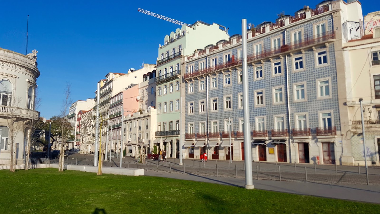
Rua Augusta and the Baixa
This is a pedestrian-only street paved with black and white mosaics. The mosaic work is called calcada. It is uniquely Portuguese art form. They date back to the 1800's but the practice goes back further than the earthquake, probably all the way back to Roman times. The patterns for these mosaics have been used for decades. Even in present times, the patterns are chosen from an official book of acceptable designs.
Baixa means low or down. The Rua Augusta is in the low town, sitting in a flat valley that sits between two hills. This is a fun street to walk down to people watch, sit in cafes, shop or just be in the moment.
The Baixa streets wee laid out in a grid. This was Prime Minister Pombal's plan. After the earthquake and tsunami, Pombal rebut the city to reflect the modern time. It was the Age of Enlightenment. Everything was supposed to be rational, logical, and according to the latest science. It was to be functional as well as beautiful.


The Elevator de Santa Justa
The elevator is a 150 foot tall iron elevator which connects the Baixa (lower town) with the upper part of town. It was built in 1902. The architect who designed it studied under Gustav Eiffel.

Rossi Square
Rossio is the liveliest square in the city, where people stop to sit and relax, or for a drink at the several cafes available. On either side of the square are two baroque fountains, and in the center a monument with a statue on the top of Dom Pedro IV. In the 19th century the square was paved with cobblestones in a wave pattern. On the north side of the square is the Dona Maria II National Theater which was built in the 1840's.


Church of Saint Nocola


Praca da Figueira

This square is a major transportation hub. Buses, trolleys and taxis can easily be taken from this area.

Sao Domingos is one of the most active churches of Lisbon today. It has a long history dating back to the 1200's. It was often used as a wedding venue for Portugal's kings and queens.
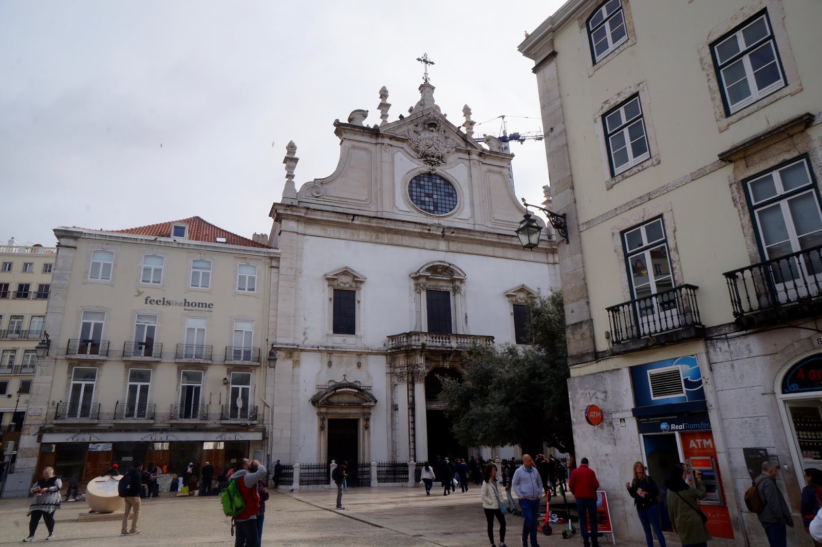
The stone columns have scars from centuries of earthquakes, fires and rebuilds. It was almost entirely destroyed by the earthquake of 1755. In the entrance some of the pre-1755 stone walls survived and there remains evidence of that fateful day by the black soot on the walls and charred stonework.


When I walked into this church, I felt a sense of awe. I only could sit in the nearest pew and experience the awesomeness of God. What a sense of peace in the middle of the bustle of the city.

This monument with the Star of David on it is a reminder that the square was once the local headquarters of the Inquisition. From the 1400's up until modern times, the Inquisition tried and punished heretics and enemies of the Catholic Church. In 1506, the city massacred the town's Jews, and a priest was executed nearby because he suggested that the 1755 earthquake was a punishment from God for the excesses of the Inquisition.

The square was also notorious in the 1500's because it hosted a slave market.


Coco-Cola is everywhere!

We stopped at one of the many restaurants with outdoor seating. We were there a little before noon. They assumed we only were there for coffee and tea and had to be hailed to take our order for food. Could we stand out as foreigners any more?!?!

Rossio Station
This train station was built around 1900. Its facade is done in Neo-Manueline style. It reflects the Golden Age of Portugal in the 1500's. The horseshoe arches design is borrowed from the Muslim Moors. Motifs of the sea can be seen in the stonework. The columns look like braided ropes on a ship. There is an armillary sphere which was a navigational device shaped like the earth surrounded by metal rings that could move, simulating the orbits of the heavenly bodies. Sailors used the armillary sphere to chart their course against the stars. Because of its significance to sailors,the armillary sphere became the symbol of the nation of Portugal.


Hotel Avenida Palace
This is Lisbon's oldest hotel. It has an elegant interior. It was popular with old WWII spies,


Outside the hotel thee statue demonstrate the laying of the mosaic tiles.


We saw this cork outside a cork shop. It is so wild, to touch and feel it
and then think of its many uses!

This was a nice park with fountains we came across in our walking around the city.


Basilica de Santa Maria
The Lisbon Cathedral, often called simply the Sé, is a Roman Catholic cathedral. This is the oldest church in the city and is the seat of the Patriarchate of Lisbon. Built in 1147, the cathedral has survived many earthquakes and has been modified, renovated and restored several times. It is nowadays a mix of different architectural styles and has been classified as a National Monument since 1910.
After the period of Visgothic domination the city was conquered by the Moors and stayed under Arab control from the 8th to the 12th century, although Christians were allowed to live in Lisbon and its surroundings. In the year 1147, the city was reconquered by an army composed of Portuguese soldiers led by King Afonso Henriques and North European crusaders taking part on the Second Crusade. An English crusader named Gilbert of Hastings was placed as bishop, and a new cathedral was built on the site of the main mosque of Lisbon.


We decided to take a trolley, but the bumbling travelers strike again. We took it the wrong way and ended in a side of the city far from any of the tourist spots. Then we were told to get off the train because there was an accident that was blocking the rails. We were not told where we were, or how to get the next train or anything? We wandered around until we found some ladies that gave us directions. That sad thing was that we ended up at the very spot we started on the train. Oh well, it was an adventure!

We then walked up from the Lisbon Cathedral to the Castle.
The views from the castle of the city were wonderful.


In the trees of the main terrace in the castle and on the ground were many peacocks. It was fun watching them roost and move around.


More scenes around the castle


A cool car we spotted upon leaving the castle

We took the Funicular to the upper town on the other side of Lisbon. The funicular trolley climbs up a steep and narrow alley, connecting the Baixa with the Bairro Alto neighborhood. Since 1885, there's been a funicular here. It works on counterbalance system. It's powered mainly by gravity. There are two cars, connected by a cable. As the top car descends, it pulls the lower car up. The funicular travels about 300 yards, climbing the hill at a bout a 10 degree angle.

After departing the funicular, we went to the right to the Miradouro de Sao Pedro de Alcantara. As we approached the park, we were serenaded by this accordion player with his dog. Of course, we had to stop and watch. The dog holds a pail for the money. It is precious!

At the park, there is the San Pedro Viewpoint. There is a great view of the city from here.


Sao Roque Church
This church was built in the 1500's when Lisbon was rich with overseas trade. Saint Roque was a devout man who spent his life helping victims of the plague. Nowadays, people come to this church to pray to St Roque about their medical conditions. This was one of Portugal's first Jesuit churches.


Convento do Carmo
This is a former convent for Carmelite nuns. It was largely destroyed in the 1755 earthquake. Today these ruins are the most powerful reminder of that event that changed Lisbon forever.


Scenes along the riverfront


Near our hotel

Our hotel was the red building.


Tile mosaics in the lobby of the hotel


Our flight home was one of the pleasant flights I have ever experienced. The plane was less than half full. The flight attendants were so relaxed not having so many people to attend. When we were flying over Iceland, one of the attendants came to me and encouraged me to go to a window seat and look outside at the view. It was astonishing. The pictures below do not even come close to the marvel that we took in.


God's beauty never ceases to amaze.